Explore the city through its trees

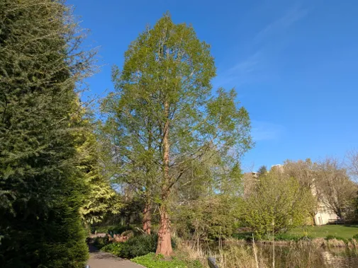
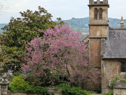
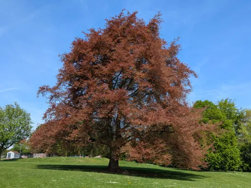
Bath is a UNESCO World Heritage City with six universal values, including the green setting of the city. There are many significant trees—in the parks and in the streets—which contribute indirectly to the World Heritage status and the wellbeing of the community.

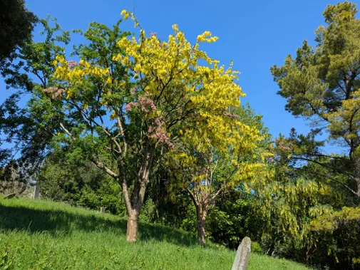
Here is our Urban Treescape in digital form, where we share a selection of trees across the city. We invite you to follow our trails and enjoy the shapes and colours of each tree - their flowers, fruits, seeds, leaves and bark—and learn something about each one, while seeing the city from a different perspective.

  • Botanical Bounty

    Trail a

    Preview photo of Botanical Bounty View Trail A

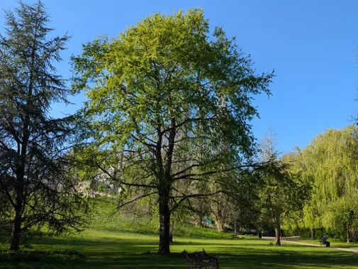
    Explore the trees north of the city centre with Botanical Bounty. This trail takes in the fantastic Royal Victoria Park, its Botanical Gardens and surrounding green spaces. Lots to entertain children on the way.

    Start Point:

    stand.never.brass

    Finish Point:

    basin.change.holly

    Distance:

    1.6 miles (2.6km)

    More details about the route

    Slopes:

    Some gentle, medium and steep slopes. Missing out Cork Oak (A4) and London Plane (A5) would avoid the steepest slopes.

    Steps or Stiles:

    Steps in The Dell in Royal Victoria Park. To avoid steps, miss out Incense Cedar (A12).

    Terrain:

    Pavement and unpaved footpath in the Dell

    Transport:

    On street parking in Royal Victoria Park. Charlotte Street car park (min 4hrs). Nearest bus stop - bthjgjw, Marlborough Buildings

    Toilets:

    Charlotte Street car park, below Royal Parade

    Refreshments:

    Convenience store at start/end of the walk on St James Parade

    Rest Points:

    There are many benches along the route in Royal Victoria Park from the Cork Oak (A4) through to the Cedar of Lebanon (A21)

    Wheel Friendly:

    Can be if you take a longer route round the back of the Dell to the Incense Cedar (A11)

    Features:

    Royal Victoria Park and, within it, the Botanical Gardens have many unusual and interesting trees. Part of the route follows along the back of the Royal Crescent

    Paper Map PDF:

    Open Trail A PDF

  • Riverside Ramble

    Trail b

    Preview photo of Riverside Ramble View Trail B

    The Riverside Ramble takes you through some fine urban trees cutting right through the city centre from west to east. Often overlooked in favour of the buildings, this route highlights some really special trees on the streets.

    Start & Finish Point:

    swan.fees.trend

    Distance:

    1.75 miles (2.8km)

    More details about the route

    Slopes:

    None

    Steps or Stiles:

    Steps by both the bridges over the river

    Terrain:

    Pavement or tarmac path throughout

    Transport:

    Kingsmead Square car park or Avon St car park. Nearest bus stop - bthjmdj, James Street West

    Toilets:

    Seven Dials, Monmouth Street near Kingsmead Sq

    Refreshments:

    Green Park Station, Salvation Army Café, Apex Hotel

    Rest Points:

    Benches along both stretches of riverside path

    Wheel Friendly:

    Not for river crossings due to steps

    Features:

    Views of the river, St John's Catholic church, Bath Abbey and Pulteney Bridge

    Paper Map PDF:

    Open Trail B PDF

  • Treemendous Twerton

    Trail c

    Preview photo of Treemendous Twerton View Trail C

    To take you right out of the city centre to the western edges of the city, Twerton has some Treemendous trees and woodland, and has a more rural feel. The street trees are just as good as any you'll find in the city centre.

    Start & Finish Point:

    jelly.blows.broad

    Distance:

    2.5 miles (4km)

    More details about the route

    Slopes:

    Some gentle slopes

    Steps or Stiles:

    Wooden steps into woodland (you can miss this section out)

    Terrain:

    Pavement and unpaved footpath through the woods (you can miss this section out)

    Transport:

    Bus stop near the start/finish (number 5), bthdmjp, Walwyn Close

    Toilets:

    Nearest - Bath City Farm and Rose Cottage (when open)

    Refreshments:

    Bath City Farm, Rose Cottage Hub, shops on High Street

    Rest Points:

    Bench in Carr's Wood

    Wheel Friendly:

    Can be, if you miss the section into Carr's Wood and continue from the Church along Newton Road

    Features:

    Carr's Wood nature reserve, trees! Close by - Bath City Farm, Innox Park

    Paper Map PDF:

    Open Trail C PDF

  • Leafy Legacies

    Trail d

    Preview photo of Leafy Legacies View Trail D

    Back into the city centre, this time travelling north to south. The Leafy Legacies trail takes in the truly iconic trees that are such an important feature of the urban streets.

    Start Point:

    shall.deep.tent

    Finish Point:

    plates.reap.shin

    Distance:

    1.25 miles (2km)

    More details about the route

    Slopes:

    Some gentle slopes

    Steps or Stiles:

    Wooden steps by Gravel Walk (there is a longer route via a slope)

    Terrain:

    Pavement or tarmac path throughout

    Transport:

    On street parking in Royal Victoria Park. Charlotte Street car park (min 4hrs). Nearest bus stop - bthjmwa, Milsom Street

    Toilets:

    Charlotte Street car park, below Royal Parade

    Refreshments:

    Various city centre cafés from Queen Square onwards

    Rest Points:

    Benches on Royal Avenue, in Queen Square and Abbey Churchyard

    Wheel Friendly:

    Yes

    Features:

    The Circus, Royal Avenue, Queen Square, Pulteney Bridge and Weir

    Paper Map PDF:

    Open Trail D PDF

  • Rob's Route

    Trail e

    Preview photo of Rob's Route View Trail E

    Start & Finish Point:

    note.begin.text

    Distance:

    3 miles (4.8km)

    More details about the route

    Slopes:

    Short grassy climb out of Moorlands Park. There is a steep uphill from Bear Flat towards Alexandra Park (if going clockwise)

    Steps or Stiles:

    Narrow kissing gate at Greenway Lane. No steps or stiles

    Terrain:

    Mix of pavement and parkland

    Transport:

    Bus: Bus stops – Bear Flat Stop (bthjgtg) towards city centre, Stop (bthjgwa) from city centre. Parking: The area is within resident permit parking zone, the best parking is Odd Down Park & Ride and take the bus to Bear Flat. There is some parking in Alexandra Park (please check closing time)

    Toilets:

    Alexandra Park (20p), cafés/bars on Bear Flat

    Refreshments:

    Bear Flat and Wellsway has shops, cafés and bars

    Rest Points:

    Alexandra Park, Moorlands Park, Bloomfield Green

    Features:

    Play areas at Alexandra Park, Moorlands Park and Bloomfield Green. Beechen Cliff Viewpoint.

    Paper Map PDF:

    Open Trail E PDF

  • Alice's Arboretum

    Trail f

    Preview photo of Alice's Arboretum View Trail F

    Start & Finish Point:

    woods.pizza.onion

    Distance:

    0.5 mile (0.8km)

    More details about the route

    Slopes:

    Mostly level

    Steps or Stiles:

    Some gates

    Terrain:

    Pavement with some grass

    Transport:

    Bus: Elm Grove/Gloucester Road (bthmajp); Lambridge stop on London Road (bthmaja) (outbound) Parking: There is a small car park at the main entrance to the park and on street parking outside the park

    Toilets:

    In the park (20p)

    Refreshments:

    Alice Park Café

    Rest Points:

    Throughout the park

    Wheel Friendly:

    All trees except one visible from the wheelchair path

    Features:

    Play area, tennis courts, quiet zone, community garden, skateboarding area

    Paper Map PDF:

    Open Trail F PDF

  • Alice's Arboretum Family Friendly

    Trail f2

    Preview photo of Alice's Arboretum Family Friendly View Trail F2

    Start & Finish Point:

    woods.pizza.onion

    Distance:

    0.5 mile (0.8km)

    More details about the route

    Slopes:

    Mostly level

    Steps or Stiles:

    Some gates

    Terrain:

    Pavement with some grass

    Transport:

    Bus: Elm Grove/Gloucester Road (bthmajp); Lambridge stop on London Road (bthmaja) (outbound). Parking: There is a small car park at the main entrance to the park and on street parking outside the park

    Toilets:

    In the park (20p)

    Refreshments:

    Alice Park Café

    Rest Points:

    Throughout the park

    Wheel Friendly:

    All trees except one visible from the wheelchair path

    Features:

    Play area, tennis courts, quiet zone, community garden, skateboarding area

    Paper Map PDF:

    Open Trail F2 PDF

  • London Road Loops

    Trail g

    Preview photo of London Road Loops View Trail G

    Start & Finish Point:

    chair.chair.trees

    Distance:

    2 miles (3.2km)

    More details about the route

    Terrain:

    1st loop: pavement with some steps, 2nd loop: pavement and riverside path – may be muddy. Flooding possible in winter

    Transport:

    Bus: London Road outside Morrisons. Parking: Free parking at Morrisons (check permitted time)

    Toilets:

    Morrisons

    Rest Points:

    Benches throughout Kensington Meadows

    Features:

    Play area in Kensington Meadows, river, view of Cleveland Pools

    Paper Map PDF:

    Open Trail G PDF

  • Combe Park Canopy

    Trail h

    Preview photo of Combe Park Canopy View Trail H

    Start & Finish Point:

    quest.fear.sleepy

    Distance:

    1 mile (1.6km)

    More details about the route

    Terrain:

    Level pavement, walking surfaces vary (wheelchair accessible if following the recommended route). There are sections through the car parks with no pedestrian pathway. Please take extra care here and avoid during morning and afternoon rush hours, when they are very busy.

    Transport:

    Bus: Number 4 bus from city centre. Parking: Public parking at RUH (Gate 1) – pay to park

    Toilets:

    Inside hospital buildings

    Refreshments:

    Public café in main hospital lobby, Friends of the RUH café @ B18; Weston village has shops and cafés

    Rest Points:

    Around the car park

    Paper Map PDF:

    Open Trail H PDF

  • Royal United Hospital ReMind UK

    Trail h2

    Preview photo of Royal United Hospital ReMind UK View Trail H2

    Start & Finish Point:

    leave.length.horns

    Distance:

    0.12 mile (0.2km)

    More details about the route

    Terrain:

    Mostly level pavements with kerbs, walking surfaces vary. There are sections through the car parks with no pedestrian pathway. Please take extra care here and avoid during morning and afternoon rush hours, when they are very busy.

    Transport:

    Bus: Number 4 bus from city centre. Parking: Public parking at RUH (Gate 1) – pay to park

    Toilets:

    Inside hospital buildings

    Refreshments:

    Public café in main hospital lobby, Friends of the RUH café @ B18; Weston village has shops and cafés

    Rest Points:

    Around the car park

    Paper Map PDF:

    Open Trail H2 PDF

Scroll down for trails

Kindly supported by

Bathscape LogoLottery Heritage Fund LogoGrant Associates Logo